Sunday, April 3, 2022

Park & Pathways for Harmony Woods? It could happen

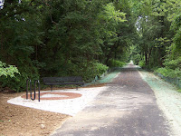
Built from the '70s through late '80s, Harmony Woods (map here) in Ogletown, Delaware, is one of  New Castle County's (NCC) largest housing developments. As required by the Unified Development Code (UDC), approx 16 acres of land was set aside as mandatory open space. Most of it is forest canopy, but several acres are grass fields and require steady maintenance (mowing). This is coordinated by the HW Civic Assoc (FB), of which funding is a frequent topic at meetings, while the space remains fallow. In virtually all other NCC communities of this size, such land is a park with place-making amenities, which the County says they are working on improving.

For some reason, a park never happened with Harmony Woods, but this space represents a magnificent opportunity that's long overdue. According to their latest newsletter (snipped below), NCC Councilman Tim Sheldon will ask for a feasibility study on a "small" park:


As seen from NCC's GIS viewer, Harmony Woods owns the parcel all the way back and immediately abutting Liberty Square Apartments. It would seem intuitive that any park proposal should take full advantage and include the maximum space available to the community. Residents frequently walk, run or bicycle on the grass and through a berm (goat path) as a connection to Prides Crossing. This berm should be eliminated for a complete flat grass park, with formal 8' asphalt pathways (pdf) added. This includes key connections from Melodic Drive to Chatham Lane or Sussex Road. These ultimately connect to the Red Mill Road pathway, East Coast Greenway (ECG DE), and the planned Ogletown Historical Site and Marker. Other pathways, as indicated in the crude map at right, should also be added, along with amenities such as park benches, kiosks and/or waysides.

Streets are the only parks and recreation in Harmony Woods
Typically, to address the concerns of any adjacent property owners who might complain, County officials will offer mitigation strategies. For example, 6-10' stockade privacy fencing or shrubs are easily installed as part of the project. Though parks are hugely favored by the overwhelming majority of citizens, there are some challenges and lots of time involved to getting it done, but we will eagerly wait. One advantage -- unlike other lost opportunities -- is that this land is already in public hands, unlike others that we are all too familiar with.

Let's hope Councilman Sheldon comes back with some good news, that Harmony Woods will finally make the best use of its open space in the form of a park, community, place-making and multi-modal connectivity. The region as a whole is hugely lacking of parks and paths, and has been disenfranchised relative to most other regions of NCC. The importance of naturehood and protection (and increase) of property values cannot be overstated, and we are elated that our civic and elected leaders see this, and are prepared to act.


Also see: Another lost park opportunity in Ogletown?

Saturday, March 26, 2022

Safety Fail: Lack of Zebra Crossings on ECG in Ogletown

Seriously eroded ECG used for car parking
With the approval of a Historical Marker commemorating Ogletown, and a quarter millennia  since the passing of its founder, the time has come to improve multi-modal access to this historic site. Regional legislators, including Senator Jack Walsh, have already agreed on action to address the failed infrastructure surrounding Thomas Ogle's tomb and green space. This includes the East Coast Greenway (ECG) west from SR273, and two connectors: one to Prides Crossing and the other to Chestnut Hill Estates via Old Ogletown Rd.

More recently, we discovered the gross lack of zebra striping of the ECG (streetview) through Chestnut Hill Plaza, a Meineke repair shop, and a Liberty gas station. Meinekie has even adopted the ROW as defacto car parking. This facility was originally paved at the width (8') required for bidirectional bike-ped traffic, and is eroded and narrowing in many sections. It rises up and back down through driveways, when the opposite is required for traffic calming and multi-modal awareness. Adding zebra crossings won't fix the problem of high speed entrances from SR4, but will bring awareness (and thus some added safety) for ECG users and Ogletown destination-making.

ECG just west of Augusta Drive
We were rebuffed in an effort to improve the Augusta Drive intersection further west. Instead, ECG continuity was broken, with a new, cars-only signal upgrade. Further west, driveways at the DE School for the Deaf (DSD) are properly aligned and zebra striped, as seen in the photo right. It would appear that Complete Streets is being applied sporadically, or by socio-economic status, with consequences that could take decades to fix.

The long range goal for the ECG is a continuous facility brought up to modern design standards, some of which can be found further to the east. Recent setbacks like Augusta, however, only cement Ogletown among the disenfranchised. When asked, there are few to no answers from several oversight orgs. In contrast, Advocates should be pouncing on each and every opportunity to improve the ECG -- even with basic highway maintenance projects as called for in DelDOT's Complete Streets policy.


This proposal
to enhance placemaking in Ogletown would bring some consolation -- not just for Thomas Ogle but also the loss of the Orphanage Property as a regional park -- the chance of which will never come again.

Saturday, March 19, 2022

Ogletown Historical Marker Approved

We are pleased to announce the approval of a Ogletown Historical Marker. This will commemorate 250 years since the passing of Thomas Ogle, and the more recent passing of Ogletown. As per Delaware Archives:

I am very pleased to notify you that the State of Delaware Historical Markers Committee has reviewed the Thomas Ogle marker application and it has been approved by the committee to receive a historical marker. The current time frame for the full completion of each marker at this point is roughly a year, which includes the research, drafting of text, fabrication, installation, and unveiling of the historical marker.

If there are any questions that I can be of assistance in answering, please let me know and I would be happy to help any way possible. I am very much looking forward to seeing Ogletown recognized for the rich history the area has to offer and will be sure to notify you all of any updates moving forward. All the best,  ~Taylor Reynolds, Delaware Historical Markers Program Coordinator


With the year ahead, we will begin advocating for pathways, place-making and infrastructure improvements with the Legislators. The following was written to area legislators whose Districts that Mr Ogle's tomb and the (coming) historical marker resides in.

Given the firmness of the approval, and as the next agreed upon step, can we please begin the infra improvement process? This is only 0.5 miles of pathways between Prides Crossing and Chestnut Hill Estates (Old SR273). This should be min. 8' asphalt with a yellow or white center line, along with ROW delineation through west side parking areas. Most of it already exists as the East Coast Greenway. We are asking for a proper rehab using MUTCD/AASHTO guidelines, and a spur path to the marker with something like this (attached, Markell Trail) at the end. This will make the marker and green space much more inviting as a historical site.  ~Francis Warnock & Angela Connolly

Click HERE for posts leading up to this approval, including the application itself.

Thursday, March 3, 2022

Delaware on track to smash 2021 crash fatals

First 2 months of 2022. Multi-year sampling periods confirm the
trend we are on. Click on image above for the latest numbers.
Cross-posted from 1st State Bikes

Statistically, Delaware is heading for a road safety disaster in 2022 - in particular New Castle County. Speeding, aggressive and distracted driving is rampant, with injuries and fatalities on pace to surpass even Florida. Despite strict laws to the contrary, many (if not most) offenders have a State-approved aftermarket and/or modified exhaust system. These behaviors account for why virtually nobody rides a bicycle for transportation or recreation -- even after 10 years of Complete Streets policy implementations.

There is virtually no pro-active law enforcement, particularly within Delaware's vast unincorporated zones. Police are few and far between, and spend most of their time answering 911 calls. An active and growing minority of drivers know this, as evidenced by the many vehicles now sporting fully tinted windows (also illegal). Even the City of Newark won't enforce the most deafening and disturbing of "loud mufflers". The lack of such basic government services has Delaware ranking criminally awful (CFPI), especially in matters of transparency. It is a top-5 worst State to live on several key socio-economic fronts, and consistently ranks as most dangerous to walk or ride a bicycle .

Mean Streets: designing cars like Dearth Vader
Our safety and quality of life is being destroyed right in front of our eyes; vehicle assault and violence is deafening our ears and ruining our health. County and State legislators offer token support, sometimes introducing bills that build on existing laws -- but these come up woefully short on enforcement. Organizations that claim to advocate for bicycling and connectivity have either given up on road safety or appear to be co-opted.

Minus a paradigm shift, and a mass conscience re-awakening toward the common good, things are only going to get worse. The suburbs, which comprises the vast majority of Delaware's built environment, are "entropy made visible", and will not be rescued unless we collectively change our thinking.

The above assaults are becoming more and more prevalent, even on Delaware's "quieter" neighborhood streets. We are trying to obtain 911 call data, that shows that this is among the most frequent emergency call types in New Castle County (stay tuned).


Above: "Bike Lane" on Red Mill Road in Ogletown. Authorities often question as to why so few people ride in Delaware, yet the answer is laid in rubber for all to see.

Thursday, January 6, 2022

How to view Ogletown in 1982, from orbit

For our sentimental followers, here are simple instructions for how to view Ogletown circa 1982. Most folks are unaware of the New Castle County GIS (Global Imaging Satellite) viewer. This is an extremely powerful tool used by County officials as they "plan" the various land-use activities, usually to the detriment of conservation Advocates of all stripes. Fortunately for us, the latest version of this application includes 1982 aerial imagery, which allows us to revert to Ogletown 40 years ago. Use the below window, or head directly to the viewer HERE.


Navigate down the left column to "1982 Aerial Imagery" and select the checkbox. Then click on the 3 horizontal dots, select "Transparency", then slide Opaque to Transparent to juxtapose today's arterial highways. It becomes clear how many structures were razed to make way for MBNA Bank and suburban sprawl.